


GPS Camera Map
4.230.00 Reviews
App Specs
- Version
- 2.1
- Updated On
- License
- Free
- Downloads
- 500,000+
- Developer
- Voice Recording
- Categories
- Travel & Local
- Platform
- Android
Screenshots
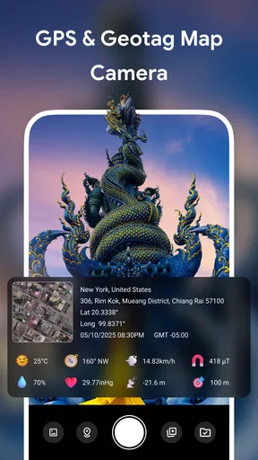
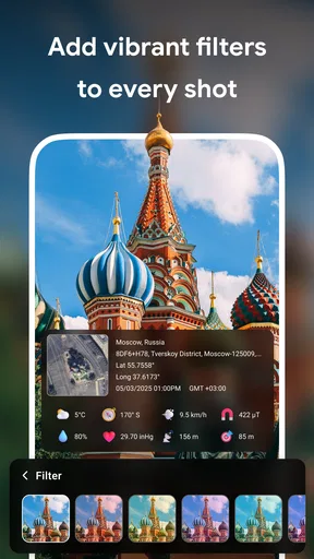
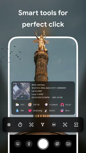
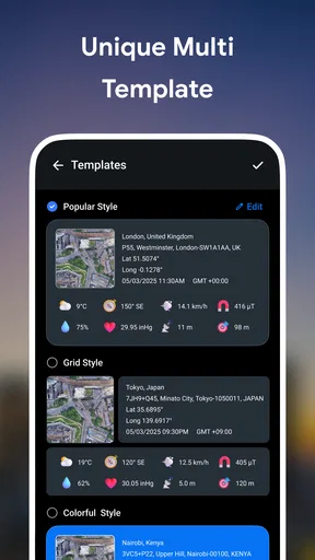
 Analysis by AppCompare
I like the idea behind GPS Camera Map: a photo can be a reminder of a place, but location and timing make it much easier to understand later. This is a travel-focused camera app from Voice Recording, and its central appeal is capturing pictures with location and other contextual details attached. I’d consider it when I want a visual record of a route or a visit, rather than just another camera for everyday snapshots.
Why trust matters with location photos
Location can make a travel photo more useful, but it also makes it more personal. A picture tagged at a public viewpoint is one thing; a photo taken near someone’s home or during a private appointment can reveal more than the image itself. I treat any camera that works with GPS as a tool to use deliberately, not as something to leave running without thinking about what I’m recording or sharing.
The app’s stated purpose is straightforward: it combines photography with contextual details such as GPS, date, time, and weather. That can save me from trying to reconstruct a trip weeks later, but it also means I would pause before sending a location-stamped image to a broad audience. The useful question is not only whether a photo looks good, but whether its attached context belongs in the copy I’m about to share.
Controls worth checking before a trip
Before relying on any GPS camera, I recommend reviewing the phone’s location and camera permissions and noticing what choices the operating system presents. Those settings are the practical point of control a user can inspect directly. I wouldn’t assume that a particular permission is optional, that location is handled in a particular way, or that the app offers a specific privacy switch unless I could see that choice on my own device.
I’d also take a test photo at home or in a familiar public place before a day out. Check the resulting image and any visible details, then decide whether the framing and information suit the way you plan to use it. This quick trial is more useful than discovering in the middle of a busy trip that your preferred photo routine needs adjustment.
Sharing deserves a separate check. If I’m sending a picture to one person, I can explain where it was taken; if I’m posting it publicly, I may prefer an image without precise location context. I would inspect the version I’m sharing rather than assume that every destination handles image details the same way. That small pause is particularly worthwhile for family photos, children’s activities, and places I visit regularly.
When location details help—and when they don’t
For a walking holiday, the extra context can help distinguish two similar-looking streets or remember which side of a lake had the better view. It is also useful for practical records: I might photograph a trail sign, a landmark, or a rental car’s parking spot and later use the location to put the image in context. These are modest uses, but they solve a familiar problem: a camera roll full of pictures that look memorable and are hard to place.
Worth Reading Before You Choose

Flipboard Shows What News Apps Must Do Beyond the Feed

Switching to Android Auto Means Rethinking Your Driving Routine

Google Calendar Makes a Crowded Week Easier to Manage

Ludo King Makes the Most of the Minutes Between Plans

Baby Panda World Brings Quick Play to Modern Phones, but Its Game Library Feels Busy

ESPN’s Live Game View Makes Following Close Games Easier
There are times when exact location is not an advantage. A photo of a private gathering, a sensitive destination, or a place someone does not want identified may be better taken with an ordinary camera workflow that does not add location context. In those situations, I’d first check what the phone and app allow me to control; if I can’t get the result I want with confidence, I’d use a different camera app and avoid sharing identifying details.
GPS can also be less helpful when I’m indoors, between tall buildings, or moving quickly. The location displayed for a photo may not be as precise as the spot where I stood, so I wouldn’t use a camera tag as proof of an exact position. For a casual memory, nearby context may be enough. For field notes or anything where precise placement matters, I’d verify the location separately rather than treat a camera stamp as authoritative.
Getting Started with GPS Camera Map
First things first, downloading and setting up the app is a breeze. The app is listed as free, though it also offers in-app purchases, and it is rated for Everyone. It was released on November 4, 2025, and version 2.1 requires Android 8.0 or later. I’d check the relevant store page for my device before installing, since those platform details matter when deciding whether it will fit my phone.
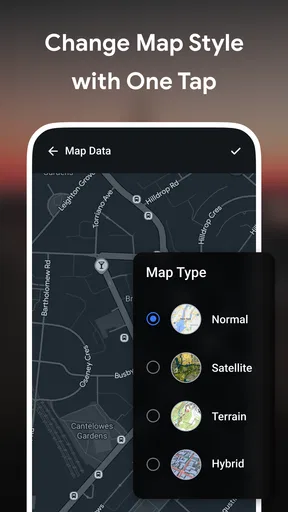
When you open the app, you'll notice it seamlessly integrates with your phone’s camera. As soon as you snap a picture, it tags the photo with GPS coordinates. What's cool is that it also provides a map view, showing exactly where each photo was taken. You can even customize this feature, choosing between different map styles like satellite or terrain.
Features That Stand Out
One of the features that I found particularly handy is the ability to add notes to each photo. Imagine standing in front of a historic landmark and jotting down a quick note about its history or your personal impressions. It's like creating a digital travel diary without the hassle of carrying a notebook.
For those who love sharing their adventures, the app makes it super easy. You can directly share your geotagged photos on social media platforms or send them via email. The geotagging feature is precise, ensuring your friends know exactly where your adventures have taken you.
Another nifty feature is the ability to organize your photos by location. The app creates albums based on where the pictures were taken, which is perfect for those of us who love keeping things organized. It even lets you search for photos by entering a specific location, which is like having a personal travel archive at your fingertips.
Making it useful beyond the postcard shot
A practical way I’d use the notes is to record details that won’t be obvious in the picture: the name of a café, which path led to a viewpoint, or why I stopped at a particular building. I’d keep notes short and searchable rather than trying to write a full diary entry while standing in a crowd. The image supplies the visual memory; a few words can supply the reason it mattered.
For a full day of sightseeing, I’d take a handful of deliberate photos rather than document every step. That makes a location-based collection easier to browse later and avoids turning a trip into a constant camera task. If I’m taking several pictures in one spot, a quick note on the first useful image can help me remember the whole stop without repeating the same information on every shot.
The map view can also change how I review a day. Instead of scrolling chronologically through a long camera roll, I can think in terms of neighborhoods or stops and use location as a memory prompt. This is especially handy when two attractions have similar interiors or when I want to retrace a walk for a friend. I would still keep a separate itinerary for bookings and opening times; a photo archive is a record of where I took pictures, not a replacement for trip planning.
Choosing it over a standard camera
The usual phone camera is the better choice when I care most about speed, familiar controls, or avoiding extra location context. A mapping or travel-planning app is better for routes, directions, and saved places. This app sits between those habits: its value is attaching a sense of place to photographs, not replacing a full navigation tool or a dedicated photo editor.
That distinction helps set expectations. If I mainly want polished images, I’d stay with a camera app built around shooting and editing. If I need a reliable record of a work site or a precise survey point, I’d use a purpose-built documentation workflow and verify its results. For a traveler who wants memories organized around places, the combination of pictures, notes, and map context is the more relevant fit.
One trade-off is that a location-rich photo is not automatically a better photo. I still need to frame the scene, check focus, and make sure the details I’m recording are useful. The extra context earns its place when I expect to revisit, sort, or share the image; otherwise, it can be unnecessary information attached to an ordinary snapshot.
Why You’ll Love It
Now, let’s talk about why you’ll be reaching for the app every time you travel. For one, it adds a layer of context to your photos that’s often missing. Sure, a picture is worth a thousand words, but knowing exactly where it was taken adds a whole new dimension.
Plus, the app’s user-friendly interface makes it accessible to everyone, from tech newbies to seasoned pros. No complicated settings, just open, point, and shoot. The added bonus of map integration and note-taking really sets it apart from other camera apps.
And if you're worried about battery usage or data consumption, the app is pretty efficient. It runs smoothly without draining your battery or hogging data, which is crucial when you’re out exploring new places.
Who is likely to get the most from it?
I’d recommend trying it if you often return from trips with a camera roll full of places you can’t name, or if you enjoy building a personal record of walks, landmarks, and stops. It may also suit people who revisit locations for hobbies such as hiking or sightseeing and want photos arranged with geographic context. The app’s 4.2 average rating, drawn from 667 ratings, and more than 500K installs suggest that many people have tried it, but those figures don’t tell me whether its workflow will match yours.
I’d be more cautious if I rarely use location in photos, dislike managing permission choices, or need advanced camera controls. A regular camera app is simpler for quick family pictures, while a dedicated map app is better for finding a route. The best reason to install this one is a real habit of wanting to connect photos with places—not merely the idea that more metadata is always better.
On a normal city day, I can picture taking a photo of a small gallery façade, adding a short note about the exhibit I liked, then using the map later to find the café nearby. That is a believable, low-effort workflow: capture the moment while it is fresh, add only the detail I might forget, and let the location help me reconstruct the outing. If I were photographing a friend’s home or a child’s regular activity, I’d instead consider whether the location detail is appropriate before sharing.
Final Thoughts
All in all, this is a worthwhile option for a travel enthusiast who wants photographs to carry more context than a date in the camera roll. It’s like having a personal photographer and travel journal rolled into one. You get to capture stunning photos while keeping track of your journey in a meaningful way.
If you’re keen on preserving your travel memories with a bit of extra detail, this app is definitely worth a shot. Whether you're exploring bustling cityscapes or serene countrysides, it ensures you’ll never forget where your adventures took you. Happy snapping!
My cautious verdict is that the app makes the most sense when location, notes, and later browsing are part of how you remember a trip. I’d test the camera and map on a low-stakes outing, review the phone’s permission choices, and think before sharing images that point to sensitive places. If that routine feels useful, the free download is an easy way to see whether it suits you; if you want a conventional camera, turn-by-turn navigation, or a controlled record for professional use, another tool will be a better match.
Pros
- Integrates with popular map services easily.
- Allows geotagging of photos instantly.
- User-friendly interface for quick navigation.
- Customizable location settings available.
- Supports high-resolution image capture.
Cons
- Consumes significant battery power quickly.
- Requires internet for map updates.
- Limited offline functionality available.
- Occasional app crashes reported by users.
- Frequent ads in free version may disrupt use.
FAQs for GPS Camera Map
What is GPS Camera Map and how does it work?
GPS Camera Map is an app that allows users to take photos with GPS coordinates embedded. It records the precise location of where the photo was taken, overlaying the data onto the image. This feature is particularly useful for travelers, outdoor enthusiasts, and professionals who need to document locations accurately.
Can I customize the information displayed on my photos?
Yes, GPS Camera Map offers customization options that allow users to choose what information appears on their photos. You can select data such as date, time, GPS coordinates, and even custom text. This flexibility makes it easy to tailor the app to meet specific documentation needs.
Is GPS Camera Map available for both Android and iOS devices?
Currently, GPS Camera Map is available for both Android and iOS platforms. You can download it from the Google Play Store for Android devices and the App Store for iOS devices. Ensure your device meets the app's system requirements for optimal performance.
Does using GPS Camera Map require an internet connection?
No, GPS Camera Map does not require an internet connection to function. The app uses the device's built-in GPS capabilities to capture location data. However, an internet connection may enhance features like map integration or sharing photos on social media.
Are there any privacy concerns with using GPS Camera Map?
GPS Camera Map includes privacy settings to protect user data. You have control over which photos are shared and can choose to disable GPS tagging if desired. It's important to review the app's privacy policy to understand how your data is handled and safeguarded.


